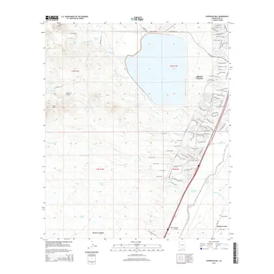
2014 Map of Esperanza Mill
USGS Topo · Published 2014About this map
The industrial and residential footprint of Pima County is well-established in this 2014 survey, where the massive water management system for the Esperanza Mill dominates the northern landscape. Large containment features like Duval Lake and the Hollywood Tank illustrate the significant hydrological infrastructure required for regional mining operations. To the east, the suburban expansion of Green Valley is documented through a dense network of residential streets such as W Esperanza Blvd and W Continental Rd, showing the community's growth toward the foothills.
Find a feature on this map
93 named features on this map. Tap any name to fly to it.
Don’t see what you’re looking for? This feature index may not catch every label — zoom into the map to look around manually.
Map Details
Editions of this 2014 Esperanza Mill Map
This is the sole edition of this map. No revisions or reprints were ever made.
Other maps of this area

1904 · Patagonia
USGS Topo · 1:125,000

1905 · Patagonia
USGS Topo · 1:125,000

1920 · Arivaca
USGS Topo · 1:125,000

1922 · Agus Caliente
USGS Topo · 1:62,500

1925 · Samaniego Peak
USGS Topo · 1:62,500

1926 · Helvetia
USGS Topo · 1:62,500

1939 · Twin Buttes
USGS Topo · 1:62,500

1939 · Tubac
USGS Topo · 1:62,500

1941 · Twin Buttes
USGS Topo · 1:62,500

1943 · Tubac
USGS Topo · 1:62,500