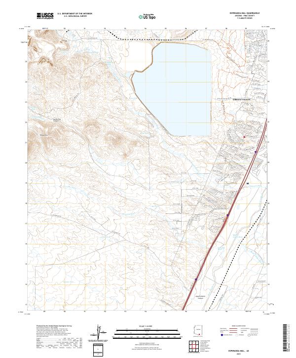
2021 Map of Esperanza Mill
USGS Topo · Published 2021About this map
The industrial and desert landscape south of Green Valley is defined by the ephemeral watercourses that drain the high ground toward the Santa Cruz River. At the heart of this terrain lies the Esperanza Mill, a focal point for the regional mineral processing industry. The map illustrates a complex network of arroyos, including Amargosa Wash, Escondido Wash, and Demetrie Wash, which carve through the arid flats. Man-made water catchments like Duval Lake, Ball Tank, and Salcedo Tank dot the landscape, indicating the critical importance of water management for both industry and ranching in this Pima County corridor.
Find a feature on this map
96 named features on this map. Tap any name to fly to it.
Don’t see what you’re looking for? This feature index may not catch every label — zoom into the map to look around manually.
Map Details
Editions of this 2021 Esperanza Mill Map
This is the sole edition of this map. No revisions or reprints were ever made.
Other maps of this area

1904 · Patagonia
USGS Topo · 1:125,000

1905 · Patagonia
USGS Topo · 1:125,000

1920 · Arivaca
USGS Topo · 1:125,000

1922 · Agus Caliente
USGS Topo · 1:62,500

1925 · Samaniego Peak
USGS Topo · 1:62,500

1926 · Helvetia
USGS Topo · 1:62,500

1939 · Twin Buttes
USGS Topo · 1:62,500

1939 · Tubac
USGS Topo · 1:62,500

1941 · Twin Buttes
USGS Topo · 1:62,500

1943 · Tubac
USGS Topo · 1:62,500