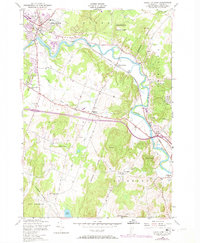
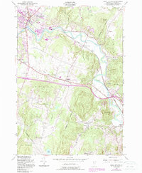
1948 Map of Essex Junction
USGS Topo · Published 1973About this map
The Winooski River winds through the heart of this mid-century landscape, serving as a geographic anchor for the evolving communities of Essex Junction and Williston. This survey, based on 1948 field checks with 1972 purple-ink revisions, captures the post-war transition of Chittenden County. Local infrastructure is well-defined, from the Central Vermont railroad tracks to industrial markers like the Brick Kiln and various Quarry sites. The map documents rural education and social life through landmarks such as the Oak Hill Sch, Lake Iroquois Sch, and the Champlain Valley Exposition grounds. Notable elevation changes are marked by Saxon Hill, Yantz Hill, and Chamberlain Hill, while smaller settlements like North Williston, Kirby Corner, and Fays Corner illustrate the historic settlement patterns between the river valleys and the shores of Lake Iroquois.
Find a feature on this map
36 named features on this map. Tap any name to fly to it.
Don’t see what you’re looking for? This feature index may not catch every label — zoom into the map to look around manually.
Map Details
Editions of this 1948 Essex Junction Map
5 editions found
Other maps of this area

1906 · Burlington
USGS Topo · 1:62,500

1913 · Milton
USGS Topo · 1:48,000

1915 · Milton
USGS Topo · 1:62,500

1919 · Burlington
USGS Topo · 1:62,500

1921 · Richmond
USGS Topo · 1:48,000

1924 · Camels Hump
USGS Topo · 1:62,500

1925 · Mount Mansfield
USGS Topo · 1:48,000

1927 · Mount Mansfield
USGS Topo · 1:62,500

1944 · Milton
USGS Topo · 1:62,500

1944 · Mount Mansfield
USGS Topo · 1:62,500