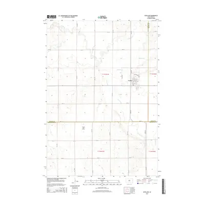
2015 Map of Estelline
USGS Topo · Published 2015About this map
Estelline serves as the central hub of this South Dakota landscape, situated at the crossroads of a grid-iron road system that defines the eastern prairie. The town's local streets, including Davis Ave E and Main St N, radiate from a compact residential and commercial core. The surrounding terrain is shaped by the Coteau des Prairies, a prominent upland plateau that influences the local drainage. Waterways like the winding Big Sioux River and its tributaries, including Bullhead Run and Hidewood Cr, meander through the townships of t113n r51w and t112n r51w. This survey captures the intersection of three counties — Hamlin, Deuel, and Brookings — showing how property and administrative lines were superimposed over the natural flow of Peg Munky Run and the broader agricultural expanse of the High Plains.
Find a feature on this map
36 named features on this map. Tap any name to fly to it.
Don’t see what you’re looking for? This feature index may not catch every label — zoom into the map to look around manually.
Map Details
Editions of this 2015 Estelline Map
This is the sole edition of this map. No revisions or reprints were ever made.
Other maps of this area

1953 · Watertown
USGS Topo · 1:250,000

1958 · Watertown
USGS Topo · 1:250,000

1968 · Brookings NE
USGS Topo · 1:24,000

1968 · Bruce
USGS Topo · 1:24,000

1968 · Arlington NE
USGS Topo · 1:24,000

1969 · Dempster
USGS Topo · 1:24,000

1969 · Castlewood
USGS Topo · 1:24,000

1969 · Lake Poinsett
USGS Topo · 1:24,000

1970 · Estelline SE
USGS Topo · 1:24,000

1970 · Estelline
USGS Topo · 1:24,000