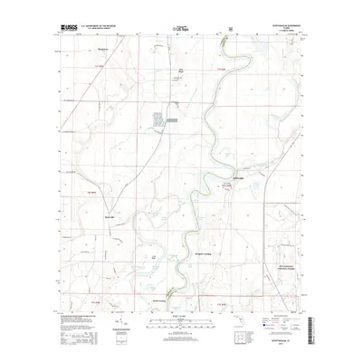
2015 Map of Estiffanulga
USGS Topo · Published 2015About this map
The Apalachicola River carves a winding path along the boundary between Calhoun Co and Liberty Co, defining a landscape of wetlands and riverside settlements. Along these banks, Estiffanulga, Mosquito Landing, and Gunn Landing speak to the area's historic reliance on the river for transport and commerce. The eastern side of the river is dominated by the dense canopy of the Apalachicola National Forest, which is traversed by the Florida National Scenic Trail.
Find a feature on this map
67 named features on this map. Tap any name to fly to it.
Don’t see what you’re looking for? This feature index may not catch every label — zoom into the map to look around manually.
Map Details
Editions of this 2015 Estiffanulga Map
This is the sole edition of this map. No revisions or reprints were ever made.
Other maps of this area

1944 · Clarksville
USGS Topo · 1:31,680

1945 · Dead Lake
USGS Topo · 1:31,680

1945 · Blountstown
USGS Topo · 1:31,680

1945 · Clarksville
USGS Topo · 1:31,680

1945 · Estiffanulga
USGS Topo · 1:31,680

1945 · Orange
USGS Topo · 1:31,680

1945 · Bristol
USGS Topo · 1:31,680

1945 · Frink
USGS Topo · 1:31,680

1945 · Woods
USGS Topo · 1:31,680
1946 · Wilma
USGS Topo · 1:31,680