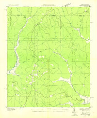
1948 Map of Estill Fork
USGS Topo · Published 1976About this map
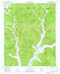
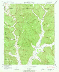
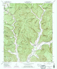
Larkin Fork and Estill Fork converge to form the upper reaches of the Paint Rock Valley in this survey of northern Jackson County, Alabama. The settlement of Estillfork serves as a small hub for the surrounding hollows, anchored by Freedom Bridge and several family-named burial grounds like Reid Cem and Swaim Cem. To the northwest, the community of Francisco sits near the Tennessee state line, marked by the Beech Grove Church.
Find a feature on this map
100 named features on this map. Tap any name to fly to it.
Don’t see what you’re looking for? This feature index may not catch every label — zoom into the map to look around manually.
Map Details
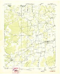
Editions of this 1948 Estill Fork Map
3 editions found
Other maps of this area

1888 · Scottsboro
USGS Topo · 1:125,000

1892 · Scottsboro
USGS Topo · 1:125,000

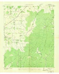
1928 · Decherd
USGS Topo · 1:62,500

1936 · King Cove
USGS Topo · 1:24,000

1936 · Hollytree
USGS Topo · 1:24,000
1936 · Beans Creek
USGS Topo · 1:24,000

1936 · Mud Creek
USGS Topo · 1:24,000
1936 · Hytop
USGS Topo · 1:24,000

1936 · Princeton
USGS Topo · 1:24,000
1936 · Huntland
USGS Topo · 1:24,000