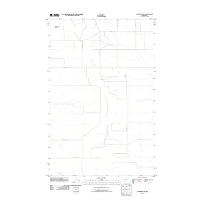
2011 Map of Ethridge NW
USGS Topo · Published 2011About this map
Old Maid Coulee carves through the northern reaches of this Glacier County landscape, providing the primary topographical relief in a region dominated by vast, sectioned agricultural lands. The map illustrates a transitional period for local infrastructure, notably showing both the modern Kevin Hwy and the path of the Old Kevin Hwy further south. The land is defined by a grid of rural thoroughfares, many bearing the names of local families who shaped the area's development. These include Dahlquist Rd, Nepstad Rd, and the distinctively named Mrs Luedtke Rd. This collection of family-named landmarks offers a significant resource for genealogists tracing the distribution of homesteads and rural estates in this portion of Montana during the early 21st century.
Find a feature on this map
11 named features on this map. Tap any name to fly to it.
Don’t see what you’re looking for? This feature index may not catch every label — zoom into the map to look around manually.
Map Details
Editions of this 2011 Ethridge NW Map
This is the sole edition of this map. No revisions or reprints were ever made.
Other maps of this area

1907 · Blackfoot Res.
USGS Topo · 1:48,000

1909 · Cut Bank
USGS Topo · 1:125,000

1912 · Cut Bank
USGS Topo · 1:125,000

1960 · Cut Bank
USGS Topo · 1:250,000

1963 · Cut Bank
USGS Topo · 1:250,000

1964 · Cut Bank
USGS Topo · 1:250,000
1966 · Ethridge
USGS Topo · 1:24,000

1966 · Ethridge NW
USGS Topo · 1:24,000
1966 · Aloe
USGS Topo · 1:24,000
1966 · Boru Spring
USGS Topo · 1:24,000