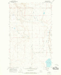
1966 Map of Aloe
USGS Topo · Published 1969About this map
Great Northern rail lines and the small settlement of Aloe anchor this mid-century survey of the high plains north of Shelby. The landscape is defined by an intricate network of seasonal drainages, including Healy Coulee, Rocky Springs Coulee, and Sand Coulee, which carve through the open terrain toward the southeastern basin. At the map's edge, Aloe Lake serves as a significant hydrologic feature in an otherwise arid region marked by early energy infrastructure. Evidence of mid-century industrial activity is present through a scattered Oil Well and a trans-territorial Pipeline that bisects the northern sections. Farther south, Potter Coulee and Spring Coulee further illustrate the water-scarce geography that shaped land use and ranching boundaries in Toole County.
Find a feature on this map
17 named features on this map. Tap any name to fly to it.
Don’t see what you’re looking for? This feature index may not catch every label — zoom into the map to look around manually.
Map Details
Editions of this 1966 Aloe Map
This is the sole edition of this map. No revisions or reprints were ever made.
Other maps of this area

1909 · Cut Bank
USGS Topo · 1:125,000

1912 · Cut Bank
USGS Topo · 1:125,000

1939 · Sunburst
USGS Topo · 1:62,500

1943 · Shelby
USGS Topo · 1:62,500

1954 · Shelby
USGS Topo · 1:250,000

1958 · Shelby
USGS Topo · 1:250,000

1960 · Cut Bank
USGS Topo · 1:250,000

1963 · Cut Bank
USGS Topo · 1:250,000

1964 · Cut Bank
USGS Topo · 1:250,000
1966 · Ethridge
USGS Topo · 1:24,000