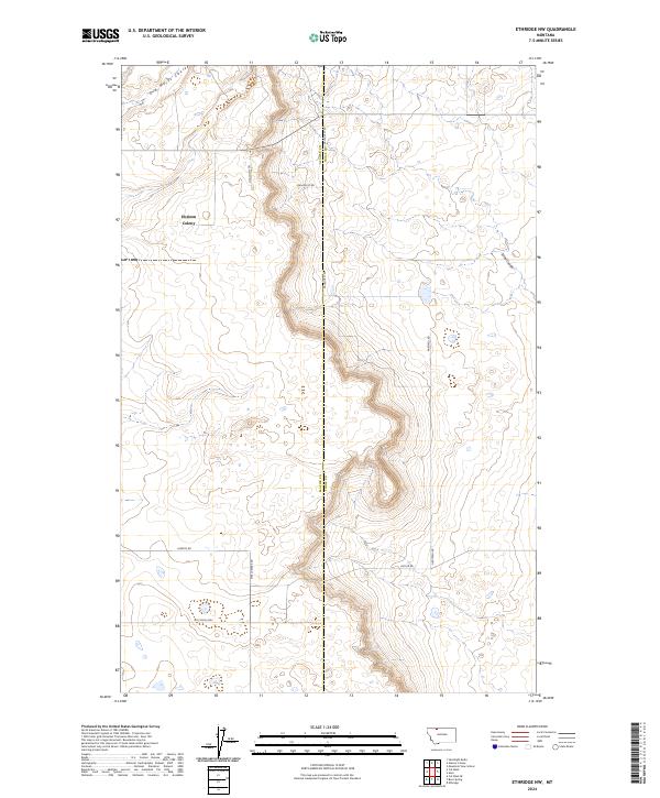
2024 Map of Ethridge NW
USGS Topo · Published 2024About this map
The Horizon Colony occupies a central position in this prairie landscape, where the high plains of northern Montana are deeply incised by drainages like Old Maids Coulee. The terrain is defined by its agricultural grid and the sharp contrast between the flat upland benches and the winding, eroded coulees. Further south, Sand Coulee cuts through the eastern sections, illustrating the water-carved topography common to this region of Toole and Glacier counties.
Find a feature on this map
16 named features on this map. Tap any name to fly to it.
Don’t see what you’re looking for? This feature index may not catch every label — zoom into the map to look around manually.
Map Details
Editions of this 2024 Ethridge NW Map
This is the sole edition of this map. No revisions or reprints were ever made.
Other maps of this area

1907 · Blackfoot Res.
USGS Topo · 1:48,000

1909 · Cut Bank
USGS Topo · 1:125,000

1912 · Cut Bank
USGS Topo · 1:125,000

1960 · Cut Bank
USGS Topo · 1:250,000

1963 · Cut Bank
USGS Topo · 1:250,000

1964 · Cut Bank
USGS Topo · 1:250,000
1966 · Ethridge
USGS Topo · 1:24,000

1966 · Ethridge NW
USGS Topo · 1:24,000
1966 · Aloe
USGS Topo · 1:24,000
1966 · Boru Spring
USGS Topo · 1:24,000