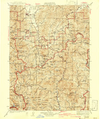
1934 Map of Etna
USGS Topo · Published 1942About this map
The Scott River valley serves as a focal point for settlement and industry in this 1930s survey of Northern California. Etna stands as a primary hub, supported by a network of peripheral operations like Vanderpoole Mill and Munson Mill. To the south, Callahan marks a significant junction where French Creek meets the river. The landscape is defined by its deep mining roots, particularly within the Shasta National Forest and Trinity National Forest, where operations such as the Society Girl Mines and Bonanza King Mine illustrate the area's mineral-driven economy.
Find a feature on this map
207 named features on this map. Tap any name to fly to it.
Don’t see what you’re looking for? This feature index may not catch every label — zoom into the map to look around manually.
Map Details
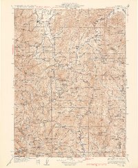
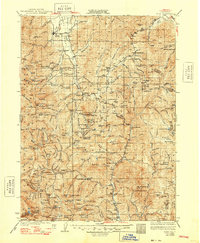
Editions of this 1934 Etna Map
4 editions found

Other maps of this area

1886 · Shasta
USGS Topo · 1:250,000

1890 · Red Bluff
USGS Topo · 1:250,000

1894 · Red Bluff
USGS Topo · 1:250,000

1894 · Shasta
USGS Topo · 1:250,000

1901 · Redding
USGS Topo · 1:125,000

1909 · Big Bar
USGS Topo · 1:96,000

1913 · Weaverville
USGS Topo · 1:125,000

1914 · Seiad
USGS Topo · 1:125,000

1915 · Big Bar and Vicinity
USGS Topo · 1:250,000

1921 · Shasta Valley Sheet No 7
USGS Topo · 1:24,000