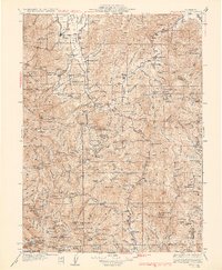
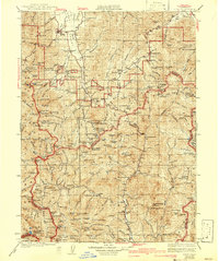
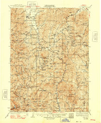
1934 Map of Etna
USGS Topo · Published 1934About this map
Etna and the high valleys of the Klamath Mountains define this 1934 topographic survey, which documents a landscape shaped by mining and timber operations. The map traces the upper reaches of the Scott River and the Trinity River, where numerous active and inactive mining sites like the Bonanza King Mine, Altoona Mine, and Dorleska Mine are scattered across the high ridges and gulches. Small settlements such as Callahan and Trinity Center serve as anchors for the rural population, supported by local institutions like McConnahue Sch and the Douglas Sch.
Find a feature on this map
186 named features on this map. Tap any name to fly to it.
Don’t see what you’re looking for? This feature index may not catch every label — zoom into the map to look around manually.
Map Details
Editions of this 1934 Etna Map
4 editions found

Other maps of this area

1886 · Shasta
USGS Topo · 1:250,000

1890 · Red Bluff
USGS Topo · 1:250,000

1894 · Red Bluff
USGS Topo · 1:250,000

1894 · Shasta
USGS Topo · 1:250,000

1901 · Redding
USGS Topo · 1:125,000

1909 · Big Bar
USGS Topo · 1:96,000

1913 · Weaverville
USGS Topo · 1:125,000

1914 · Seiad
USGS Topo · 1:125,000

1915 · Big Bar and Vicinity
USGS Topo · 1:250,000

1921 · Shasta Valley Sheet No 7
USGS Topo · 1:24,000