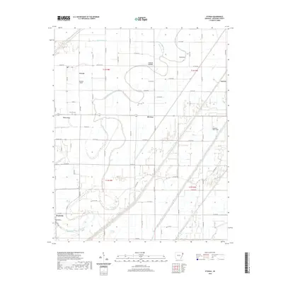
2020 Map of Etowah
USGS Topo · Published 2020About this map
Etowah and its surrounding agricultural landscape in Mississippi County are defined by a complex network of man-made drainage systems and relic watercourses. The territory is crisscrossed by numeric channels like Ditch Number 18 and Ditch Number 19, essential for managing the low-lying terrain of the Tyronza Sunk Lands. These engineering efforts transformed the wetlands into productive farmland, though the original hydrology remains visible in features such as the Left Hand Chute of Little River and Caney Old River. Small crossroads communities and family landmarks, including Carrol Corner and Gant Cem, are scattered throughout this flat expanse. The map also documents geographic anomalies like Jacksons Island and Grays Bend, illustrating how the shifting paths of the Arkansas Delta's waterways have historically shaped property lines and settlement patterns in townships like t13n r8e and t12n r9e.
Find a feature on this map
50 named features on this map. Tap any name to fly to it.
Don’t see what you’re looking for? This feature index may not catch every label — zoom into the map to look around manually.
Map Details
Editions of this 2020 Etowah Map
This is the sole edition of this map. No revisions or reprints were ever made.
Other maps of this area

1939 · Evadale
USGS Topo · 1:62,500

1941 · Leachville
USGS Topo · 1:62,500

1941 · Manila
USGS Topo · 1:62,500

1941 · Marked Tree
USGS Topo · 1:62,500

1953 · Memphis
USGS Topo · 1:250,000

1956 · Leachville
USGS Topo · 1:62,500

1956 · Manila
USGS Topo · 1:62,500

1956 · Evadale
USGS Topo · 1:62,500

1956 · Marked Tree
USGS Topo · 1:62,500

1956 · Memphis
USGS Topo · 1:250,000