2024 Map of Etowah
USGS Topo · Published 2024About this map
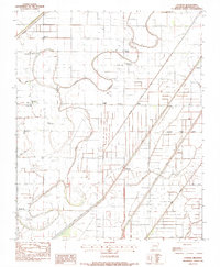
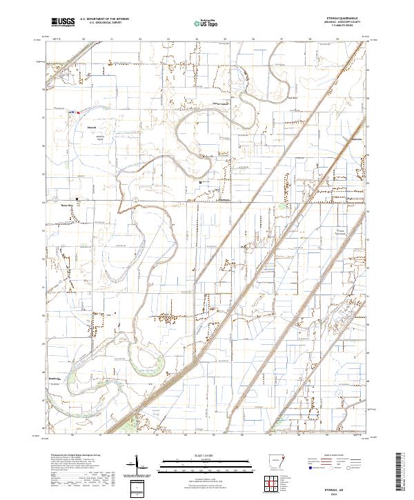
Left Hand Chute of Little River defines the landscape of this Mississippi County region, winding through a complex network of drainage ditches and ancient riverbeds. The settlement of Etowah serves as a primary hub, surrounded by smaller communities such as Carrol Corner, Athelstan, and Three Way. The map reveals the intricate hydrology of the Delta, where the Tyronza Sunk Lands and the Tyronza Cut-off highlight the historical geological shifts and engineering efforts characteristic of this part of Arkansas. Local genealogy and history researchers can find specific landmarks like Gant Cem and Three Way Cem, alongside land features such as Jacksons Island and Grays Bend. The grid-like patterns of agricultural roads, including State Hwy 136 and numerous county routes, reflect the intensive land use of the river-basin environment.
Find a feature on this map
66 named features on this map. Tap any name to fly to it.
Don’t see what you’re looking for? This feature index may not catch every label — zoom into the map to look around manually.
Map Details
Editions of this 2024 Etowah Map
This is the sole edition of this map. No revisions or reprints were ever made.