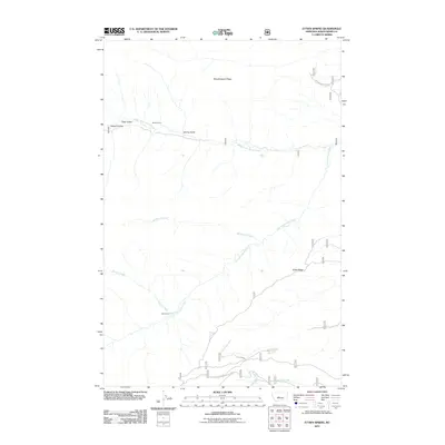
2011 Map of Ettien Spring
USGS Topo · Published 2011About this map
Middle Fork Judith River and its numerous tributaries define the drainage patterns of this high-country landscape in Judith Basin County. The map documents a rugged network of forest service roads and trails, such as Ettien-Russian Cr, winding through prominent topographical features like Woodchopper Ridge and Ettien Ridge. Remote outposts and human presence are marked by the Korell Cabin and Burris Cabin, which sit along the banks of Spring Gulch and Burris Creek respectively. The southern portion of the sheet features a local landmark intersection known as 5 Corners, serving as a waypoint for the network of mountain routes. This terrain, characterized by deep draws like Deer Gulch and Halzell Coulee, highlights the isolated character of the Little Belt Mountains watershed in the early twenty-first century.
Find a feature on this map
31 named features on this map. Tap any name to fly to it.
Don’t see what you’re looking for? This feature index may not catch every label — zoom into the map to look around manually.
Map Details
Editions of this 2011 Ettien Spring Map
This is the sole edition of this map. No revisions or reprints were ever made.
Other maps of this area

1886 · Little Belt Mts.
USGS Topo · 1:250,000

1894 · Little Belt Mts.
USGS Topo · 1:250,000

1897 · Little Belt Mts.
USGS Topo · 1:250,000

1898 · Little Belt Mts.
USGS Topo · 1:250,000

1902 · Little Belt Mts.
USGS Topo · 1:250,000

1948 · White Sulphur Springs
USGS Topo · 1:250,000

1958 · White Sulphur Springs
USGS Topo · 1:250,000

1961 · White Sulphur Springs
USGS Topo · 1:250,000
1961 · Yogo Peak
USGS Topo · 1:24,000
1961 · Sand Point
USGS Topo · 1:24,000