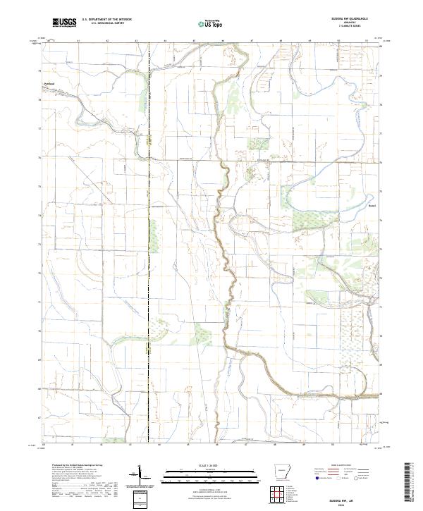
2024 Map of Eudora NW
USGS Topo · Published 2024About this map
The town of Portland sits at the northwestern edge of this landscape, where the flat alluvial plains of the Arkansas Delta are defined by an intricate network of waterways. The meandering paths of Dry Bayou, Big Bayou, and Crooked Bayou dominate the drainage pattern, illustrating the hydrologic complexity of the region. These bayous are interspersed with agricultural tracts and woodlots, connected by a grid of rural routes including Portland Rd and Montgomery Rd. Further south, the settlement at Boeuf is situated near the slow-moving Lafourche Bayou and Fleschmans Bayou. This 2024 survey documents the contemporary arrangement of parish and county boundaries, specifically the Ashley Co Chicot Co line, which divides these agricultural lands. The map reflects a landscape deeply tied to its watercourses, where road placement and land divisions follow the natural contours of the ancient river floodplains.
Find a feature on this map
29 named features on this map. Tap any name to fly to it.
Don’t see what you’re looking for? This feature index may not catch every label — zoom into the map to look around manually.
Map Details
Editions of this 2024 Eudora NW Map
This is the sole edition of this map. No revisions or reprints were ever made.
Other maps of this area

1935 · Mist
USGS Topo · 1:62,500

1935 · Wilmot
USGS Topo · 1:62,500

1936 · Eudora
USGS Topo · 1:62,500

1936 · Lake Village
USGS Topo · 1:62,500

1953 · Greenwood
USGS Topo · 1:250,000

1955 · Lake Village
USGS Topo · 1:62,500

1956 · Greenwood
USGS Topo · 1:250,000

1957 · Eudora
USGS Topo · 1:62,500

1960 · Snyder
USGS Topo · 1:24,000

1960 · Mist
USGS Topo · 1:62,500