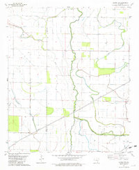
1981 Map of Eudora NW
USGS Topo · Published 1982About this map
The low-lying alluvial plains along the border of Ashley and Chicot Counties are defined by a complex network of meandering waterways and drainage systems. Published in 1982, this survey illustrates a landscape dominated by agricultural development, punctuated by rural landmarks such as Brown Chapel and Aulds Ch. The intricate hydrology of the region is evident in the winding courses of Big Bayou, Crooked Bayou, and Dry Bayou, alongside engineered features like Canal No 2. Numerous wells and flumes across the terrain suggest the critical role of water management for local farming in this portion of southeast Arkansas. Small tributaries such as Fleschmans Creek and Hogpen Creek feed into the larger bayou system, creating a distinct environmental pattern typical of the Mississippi Delta's western edge.
Find a feature on this map
12 named features on this map. Tap any name to fly to it.
Don’t see what you’re looking for? This feature index may not catch every label — zoom into the map to look around manually.
Map Details
Editions of this 1981 Eudora NW Map
This is the sole edition of this map. No revisions or reprints were ever made.
Other maps of this area

1935 · Mist
USGS Topo · 1:62,500

1935 · Wilmot
USGS Topo · 1:62,500

1936 · Eudora
USGS Topo · 1:62,500

1936 · Lake Village
USGS Topo · 1:62,500

1953 · Greenwood
USGS Topo · 1:250,000

1955 · Lake Village
USGS Topo · 1:62,500

1956 · Greenwood
USGS Topo · 1:250,000

1957 · Eudora
USGS Topo · 1:62,500

1960 · Snyder
USGS Topo · 1:24,000

1960 · Mist
USGS Topo · 1:62,500