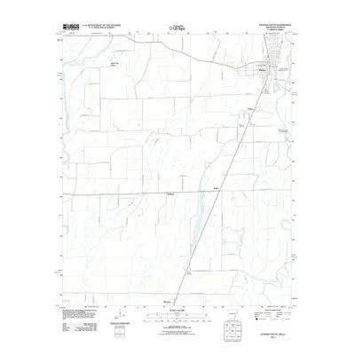
2011 Map of Eudora South
USGS Topo · Published 2011About this map
Eudora and the surrounding agricultural landscape of Chicot County sit at the heart of this survey, where the lowlands are defined by the winding course of Bayou Macon and the Boeuf River. The map documents a rural corridor stretching southward to Kilbourne, crossing the Arkansas Louisiana state line. This borderland territory is dotted with small settlements like Hanna, Wellford, and Ross Van Ness, connected by a network of local roads such as Ross Van Ness Rd and Ball Rd that follow the section lines of the Delta. Local history is anchored in sites like Mount Carmel Cemetery and Masons Cemetery, while the presence of the Baker Flying Service Airport and Ball Lake Dam Number Two reflects the modern infrastructure supporting the region's long-standing connection to the land and its waterways, including Caney Bayou and Hill Bayou.
Find a feature on this map
57 named features on this map. Tap any name to fly to it.
Don’t see what you’re looking for? This feature index may not catch every label — zoom into the map to look around manually.
Map Details
Editions of this 2011 Eudora South Map
This is the sole edition of this map. No revisions or reprints were ever made.
Other maps of this area

1909 · Millikin
USGS Topo · 1:24,000

1909 · Ashton Bridge
USGS Topo · 1:24,000

1912 · Ashton Bridge
USGS Topo · 1:31,680

1935 · Oak Grove
USGS Topo · 1:62,500

1936 · Eudora
USGS Topo · 1:62,500

1939 · Readland
USGS Topo · 1:62,500

1939 · Mayersville
USGS Topo · 1:62,500

1953 · Greenwood
USGS Topo · 1:250,000

1955 · Jackson
USGS Topo · 1:250,000

1956 · Greenwood
USGS Topo · 1:250,000