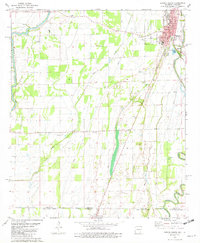
1981 Map of Eudora South
USGS Topo · Published 1982About this map
The delta landscapes of Chicot County and West Carroll Parish meet at the state line in this early 1980s survey. The town of Eudora serves as the primary hub, showing a grid of streets like Main St and Worthington Ave alongside the Missouri Pacific railroad. A dense concentration of rural houses of worship defines the social geography, ranging from the Gospel Temple and New Hope Ch in the north to the St Paul Ch and St Peter Ch further south near Indian Bayou.
Find a feature on this map
48 named features on this map. Tap any name to fly to it.
Don’t see what you’re looking for? This feature index may not catch every label — zoom into the map to look around manually.
Map Details
Editions of this 1981 Eudora South Map
This is the sole edition of this map. No revisions or reprints were ever made.
Other maps of this area

1909 · Millikin
USGS Topo · 1:24,000

1909 · Ashton Bridge
USGS Topo · 1:24,000

1912 · Ashton Bridge
USGS Topo · 1:31,680

1935 · Oak Grove
USGS Topo · 1:62,500

1936 · Eudora
USGS Topo · 1:62,500

1939 · Readland
USGS Topo · 1:62,500

1939 · Mayersville
USGS Topo · 1:62,500

1953 · Greenwood
USGS Topo · 1:250,000

1955 · Jackson
USGS Topo · 1:250,000

1956 · Greenwood
USGS Topo · 1:250,000