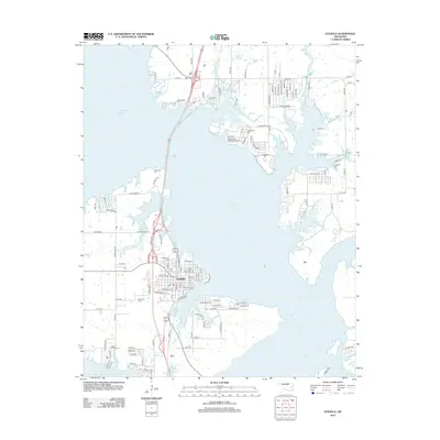
2012 Map of Eufaula
USGS Topo · Published 2012About this map
Eufaula sits as the central hub of this lakeside landscape, positioned at a critical junction where land-based transit meets the massive reach of Eufaula Lake. The town's grid is bounded by the water to the east and south, with several smaller tributaries like Baptizing Cr and Carr Cr carving into the shoreline. This 2012 survey reveals a complex network of residential development stretching north and east along the lakefront, particularly around Terra Star Rd and Koch Dr.
Find a feature on this map
117 named features on this map. Tap any name to fly to it.
Don’t see what you’re looking for? This feature index may not catch every label — zoom into the map to look around manually.
Map Details
Editions of this 2012 Eufaula Map
This is the sole edition of this map. No revisions or reprints were ever made.
Other maps of this area

1900 · Sansbois
USGS Topo · 1:125,000

1900 · Canadian
USGS Topo · 1:125,000

1909 · Sans Bois
USGS Topo · 1:125,000

1911 · Sansbois
USGS Topo · 1:125,000

1946 · Fort Smith
USGS Topo · 1:250,000

1962 · Pierce
USGS Topo · 1:24,000

1963 · Warner NW
USGS Topo · 1:24,000

1963 · Stidham
USGS Topo · 1:24,000

1963 · Eufaula
USGS Topo · 1:24,000

1963 · Checotah
USGS Topo · 1:24,000