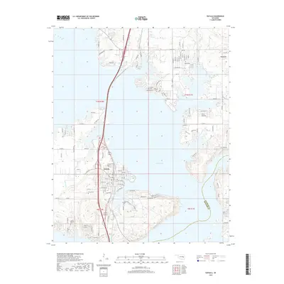
2018 Map of Eufaula
USGS Topo · Published 2018About this map
Eufaula Lake dominates this modern landscape in eastern Oklahoma, its winding arms and inlets shaping the growth of the surrounding McIntosh County communities. In the southwest, the town of Eufaula serves as a focal point, situated near the confluence of major regional transit routes like Old Hwy 69. The map reveals a deeply personal geography through its preservation of local history, marking numerous small burial sites such as Lawson Williams Cem and Evergreen Cem. To the northeast, the settlement of Texanna sits near the northern reaches of the lake. The terrain is a mix of developed shoreline and rural expanses, where older landmarks like the Greenwood Sch and Fishertown Cem persist amidst newer residential infrastructure, illustrating the long-term settlement patterns of the Eufaula basin.
Find a feature on this map
29 named features on this map. Tap any name to fly to it.
Don’t see what you’re looking for? This feature index may not catch every label — zoom into the map to look around manually.
Map Details
Editions of this 2018 Eufaula Map
This is the sole edition of this map. No revisions or reprints were ever made.
Other maps of this area

1900 · Sansbois
USGS Topo · 1:125,000

1900 · Canadian
USGS Topo · 1:125,000

1909 · Sans Bois
USGS Topo · 1:125,000

1911 · Sansbois
USGS Topo · 1:125,000

1946 · Fort Smith
USGS Topo · 1:250,000

1962 · Pierce
USGS Topo · 1:24,000

1963 · Warner NW
USGS Topo · 1:24,000

1963 · Stidham
USGS Topo · 1:24,000

1963 · Eufaula
USGS Topo · 1:24,000

1963 · Checotah
USGS Topo · 1:24,000