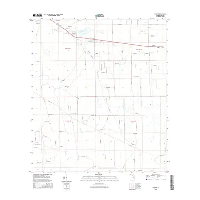
2015 Map of Eugene
USGS Topo · Published 2015About this map
The small community of Eugene serves as a focal point in this 2015 survey of central Dixie County, situated along a network of numbered forest and residential roads. The landscape is defined by its low-lying hydrology, where the Airport Canal and the meandering California Cr drainage systems navigate the flat terrain. Local heritage is centered around the Long Pond Cem near the banks of Long Pond, providing a significant point of interest for genealogists tracking family roots in this corner of the Florida Big Bend. To the east, the Old Town Hammock suggests a transition into denser hardwood forest environments, a characteristic of the Gulf coastal plain. The grid of section lines and the distribution of small farmsteads and rural residences illustrate a modern era of land management that still respects the underlying natural geography of the region.
Find a feature on this map
58 named features on this map. Tap any name to fly to it.
Don’t see what you’re looking for? This feature index may not catch every label — zoom into the map to look around manually.
Map Details
Editions of this 2015 Eugene Map
This is the sole edition of this map. No revisions or reprints were ever made.
Other maps of this area

1954 · Cross City West
USGS Topo · 1:24,000

1954 · Eugene
USGS Topo · 1:24,000

1954 · Cross City East
USGS Topo · 1:24,000

1954 · Cross City SW
USGS Topo · 1:24,000

1954 · Manatee Springs
USGS Topo · 1:24,000

1954 · Vista
USGS Topo · 1:24,000

1954 · Gainesville
USGS Topo · 1:250,000

1955 · Shired Island
USGS Topo · 1:24,000

1958 · Gainesville
USGS Topo · 1:250,000

1959 · Gainesville
USGS Topo · 1:250,000