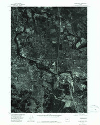
1975 Map of Eugene East
USGS Topo · Published 1979About this map
The Willamette River winds through this 1975 orthophotoquad, serving as the central geographic feature between the growing mid-seventies urban centers of Eugene and Springfield. Unlike traditional topographic maps, this aerial imagery, produced in cooperation with the Soil Conservation Service, provides a direct photographic record of the land use and residential expansion during this era. The dense street grids and commercial developments are visible in sharp contrast to the wooded hills and agricultural parcels that still bordered the metropolitan area. The imagery captures the specific footprint of industrial sites and infrastructure as they existed in the mid-1970s, offering a raw visual perspective on the development patterns of Lane County during a period of significant regional growth.
Find a feature on this map
3 named features on this map. Tap any name to fly to it.
Don’t see what you’re looking for? This feature index may not catch every label — zoom into the map to look around manually.
Map Details
Editions of this 1975 Eugene East Map
This is the sole edition of this map. No revisions or reprints were ever made.
Other maps of this area

1910 · Eugene
USGS Topo · 1:62,500

1921 · Cottage Grove
USGS Topo · 1:62,500

1935 · Lowell
USGS Topo · 1:96,000

1940 · Eugene
USGS Topo · 1:62,500

1942 · Lowell
USGS Topo · 1:125,000

1946 · Eugene
USGS Topo · 1:62,500

1949 · Eugene
USGS Topo · 1:62,500

1950 · Marcola
USGS Topo · 1:62,500

1952 · Marcola
USGS Topo · 1:62,500

1953 · Salem
USGS Topo · 1:250,000