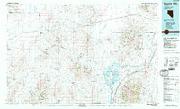
1985 Map of Eugene Mts
USGS Topo · Published 1985About this map
The Nevada-Massachusetts (Tungsten) Mine stands as a significant industrial landmark in this high-desert landscape of northwestern Nevada, situated near the Eugene Mountains. This 1985 compilation reveals a region defined by mineral extraction and water management, where the Humboldt River feeds into the Rye Patch Reservoir and the Upper Pitt-Taylor Reservoir. Small rail-aligned settlements like Sulphur and Jungo punctuate the vast reaches between the Antelope Range and the Kamma Mountains. The presence of numerous named shafts such as the Stank Mine and Golden Eagle Mine illustrates the enduring importance of the mining districts that historically supported local economies. Transportation is dominated by the Southern Pacific railroad and routes through Poker Brown Gap, while the Rye Patch State Recreation Area marks a shift toward public land use along the river corridor.
Find a feature on this map
83 named features on this map. Tap any name to fly to it.
Don’t see what you’re looking for? This feature index may not catch every label — zoom into the map to look around manually.
Map Details
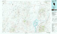
Editions of this 1985 Eugene Mts Map
2 editions found
Other maps of this area

1882 · Paradise
USGS Topo · 1:250,000

1886 · Disaster
USGS Topo · 1:250,000

1886 · Granite Range
USGS Topo · 1:250,000

1889 · Long Valley
USGS Topo · 1:250,000

1893 · Paradise
USGS Topo · 1:250,000

1893 · Disaster
USGS Topo · 1:250,000

1894 · Granite Range
USGS Topo · 1:250,000

1931 · Lovelock
USGS Topo · 1:250,000

1932 · Sonoma Range
USGS Topo · 1:250,000

1935 · Lovelock
USGS Topo · 1:250,000