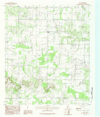
1984 Map of Eula
USGS Topo · Published 1984About this map
Eula serves as the central hub of this West Texas landscape in the mid-1980s, where small-town infrastructure like a Rodeo Arena, Athletic Field, and a localized Landing Strip contrast with the surrounding agricultural and industrial use. To the south, the terrain rises significantly toward Eagle Mountain and the prominent Lytle Gap, where the Divide separates the drainage of Lytle Creek from the eastern-flowing North Prong Pecan Bayou.
Find a feature on this map
23 named features on this map. Tap any name to fly to it.
Don’t see what you’re looking for? This feature index may not catch every label — zoom into the map to look around manually.
Map Details
Editions of this 1984 Eula Map
This is the sole edition of this map. No revisions or reprints were ever made.
Other maps of this area

1890 · Abilene
USGS Topo · 1:125,000

1892 · Abilene
USGS Topo · 1:125,000

1931 · Baird
USGS Topo · 1:125,000

1932 · Baird
USGS Topo · 1:125,000

1954 · Abilene
USGS Topo · 1:250,000

1957 · Kirby Lake
USGS Topo · 1:62,500

1957 · Abilene East
USGS Topo · 1:24,000

1958 · Abilene
USGS Topo · 1:250,000
1966 · Baird
USGS Topo · 1:24,000
1966 · Cub Hollow
USGS Topo · 1:24,000