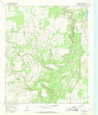
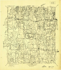
1966 Map of Cub Hollow
USGS Topo · Published 1970About this map
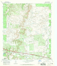
Kaiser Creek and Mexia Creek define the drainage patterns of this Callahan County landscape as it appeared in the mid-1960s. The terrain is dominated by the winding course of the North Prong Pecan Bayou, which cuts through the central portion of the sheet. Human activity is marked by the presence of a small settlement at Todd and a network of petroleum infrastructure, indicated by numerous Oil Wells scattered across the northern and western sections.
Find a feature on this map
12 named features on this map. Tap any name to fly to it.
Don’t see what you’re looking for? This feature index may not catch every label — zoom into the map to look around manually.
Map Details
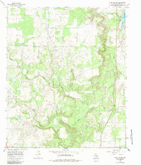
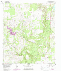
Editions of this 1966 Cub Hollow Map
Other maps of this area

1890 · Abilene
USGS Topo · 1:125,000

1892 · Abilene
USGS Topo · 1:125,000
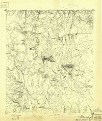
1931 · Baird
USGS Topo · 1:125,000
1932 · Baird
USGS Topo · 1:125,000

1954 · Abilene
USGS Topo · 1:250,000
1957 · Kirby Lake
USGS Topo · 1:62,500

1958 · Abilene
USGS Topo · 1:250,000
1966 · Baird
USGS Topo · 1:24,000
1966 · Admiral
USGS Topo · 1:24,000
1966 · Jayell
USGS Topo · 1:24,000