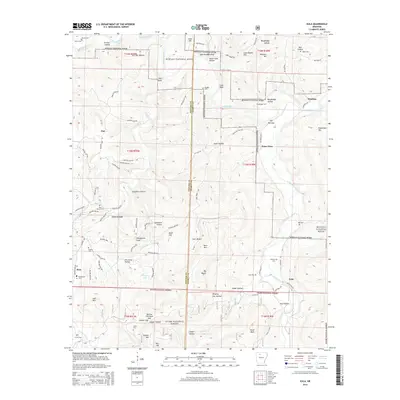
2014 Map of Eula
USGS Topo · Published 2014About this map
Buffalo River corridors and the dense woodlands of the Ozark National Forest define this landscape along the border of Newton and Searcy counties. Small, dispersed settlements like Bass, Cave Creek, and Woolum are connected by a network of winding roads, including Newton 4260 Rd and Newton 4880 Rd, which navigate the complex terrain of the Boston Mountains. The map reveals a high concentration of family and community burial sites, such as Hensley Cem, Old Dodson Cem, and Abbey Cem, providing significant touchstones for genealogical research in this rural region.
Find a feature on this map
102 named features on this map. Tap any name to fly to it.
Don’t see what you’re looking for? This feature index may not catch every label — zoom into the map to look around manually.
Map Details
Editions of this 2014 Eula Map
This is the sole edition of this map. No revisions or reprints were ever made.
Other maps of this area

1892 · Marshall
USGS Topo · 1:125,000

1893 · Yellville
USGS Topo · 1:125,000

1894 · Marshall
USGS Topo · 1:125,000

1901 · Marshall
USGS Topo · 1:125,000

1903 · Yellville
USGS Topo · 1:125,000

1904 · Harrison
USGS Topo · 1:125,000

1905 · Harrison
USGS Topo · 1:125,000

1905 · Yellville
USGS Topo · 1:125,000

1929 · Yellville
USGS Topo · 1:125,000

1933 · Mt Judea
USGS Topo · 1:62,500