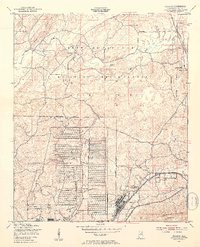
1947 Map of Eulaton
USGS Topo · Published 1953About this map
The Anniston Ordnance Depot and the sprawling Fort McClellan Military Reservation dominate this post-war landscape in Calhoun County. The military footprint is striking, particularly the dense grid of storage facilities at the depot and the expansive Pelham Range to the north. These federal installations are juxtaposed with small, rural communities and family-centered landmarks that defined local life before and during the war.
Find a feature on this map
23 named features on this map. Tap any name to fly to it.
Don’t see what you’re looking for? This feature index may not catch every label — zoom into the map to look around manually.
Map Details
Editions of this 1947 Eulaton Map
2 editions found

Other maps of this area

1889 · Springville
USGS Topo · 1:125,000

1892 · Springville
USGS Topo · 1:125,000

1900 · Anniston
USGS Topo · 1:125,000

1947 · Oxford
USGS Topo · 1:24,000

1947 · Anniston
USGS Topo · 1:24,000

1947 · Eastaboga
USGS Topo · 1:24,000

1947 · Ragland
USGS Topo · 1:62,500

1947 · Jacksonville
USGS Topo · 1:24,000

1947 · Wellington
USGS Topo · 1:24,000

1947 · Francis Mill
USGS Topo · 1:24,000