
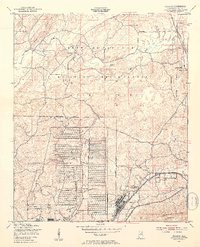
1947 Map of Eulaton
USGS Topo · Published 1953About this map
The Anniston Ordnance Depot dominates this post-war landscape, revealing the massive grid of storage bunkers and infrastructure established in Calhoun County. North of the depot, the Fort McClellan Military Reservation encompasses the Pelham Range, where the terrain transitions from the valley floors to the heights of Coldwater Mountain. The map provides a detailed view of the interaction between military expansion and established rural communities such as Morrisville, Peaceburg, and Eulaton.
Find a feature on this map
24 named features on this map. Tap any name to fly to it.
Don’t see what you’re looking for? This feature index may not catch every label — zoom into the map to look around manually.
Map Details
Editions of this 1947 Eulaton Map
2 editions found
Other maps of this area

1889 · Springville
USGS Topo · 1:125,000

1892 · Springville
USGS Topo · 1:125,000

1900 · Anniston
USGS Topo · 1:125,000

1947 · Oxford
USGS Topo · 1:24,000

1947 · Anniston
USGS Topo · 1:24,000

1947 · Eastaboga
USGS Topo · 1:24,000

1947 · Ragland
USGS Topo · 1:62,500

1947 · Jacksonville
USGS Topo · 1:24,000

1947 · Wellington
USGS Topo · 1:24,000

1947 · Francis Mill
USGS Topo · 1:24,000