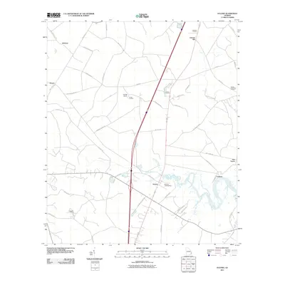
2011 Map of Eulonia
USGS Topo · Published 2011About this map
The Sapelo River meanders through this coastal Georgia landscape, defining the character of the settlements from Eulonia to the tidal reaches of Pine Harbor. This 2011 survey captures a region where agriculture and maritime proximity intersect, evidenced by the scattered small communities like Brickston and Warsaw and the aviation infrastructure at Beasons Landing Strip. Genealogists will find significant value in the distribution of family and community burial sites across the terrain, including Mcintosh Cemetery, Youngs Cemetery, and the Buckley and O'Neal Cemetery. The presence of Buck Hill Swamp and various island-related names like Youngs Island suggests a low-lying geography where historical transportation relied on elevated tracks such as Tram Rd and the winding network of local routes like Shellman Bluff Rd.
Find a feature on this map
47 named features on this map. Tap any name to fly to it.
Don’t see what you’re looking for? This feature index may not catch every label — zoom into the map to look around manually.
Map Details
Editions of this 2011 Eulonia Map
This is the sole edition of this map. No revisions or reprints were ever made.
Other maps of this area

1918 · Everett City
USGS Topo · 1:62,500

1920 · Sapelo River
USGS Topo · 1:62,500

1920 · Everett City
USGS Topo · 1:62,500

1921 · Darien
USGS Topo · 1:62,500

1943 · Ludowici
USGS Topo · 1:62,500

1943 · Sapelo River
USGS Topo · 1:62,500

1944 · Everett City
USGS Topo · 1:62,500

1945 · Sapelo River
USGS Topo · 1:62,500

1946 · Brunswick
USGS Topo · 1:250,000

1948 · Brunswick
USGS Topo · 1:250,000