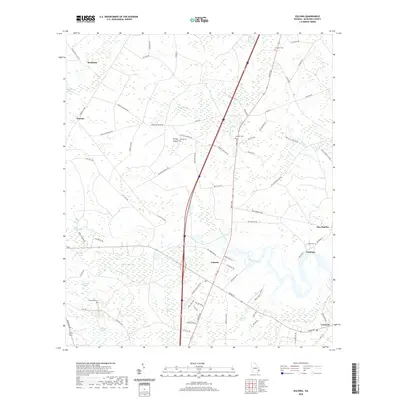
2020 Map of Eulonia
USGS Topo · Published 2020About this map
The Sapelo River meanders through a landscape defined by extensive coastal wetlands and established communities in this modern survey of McIntosh County. The settlement of Eulonia serves as a central hub, situated near the intersection of major thoroughfares and surrounded by a network of named wetlands, including Buck Hill Swamp and Pine Hill Swamp. To the east, the riverside developments of Fairhope and Pine Harbor reflect the region's connection to the water, while the inland areas are dotted with family-named landmarks and historic resting places such as McIntosh Cem and Andrews Cem. The map reveals a transition from the structured residential roads of Crescent to the more dispersed settlements of Warsaw and Brickston, illustrating how the low-lying terrain and drainage basins like Big Mortar Swamp have shaped the local infrastructure and land use patterns.
Find a feature on this map
77 named features on this map. Tap any name to fly to it.
Don’t see what you’re looking for? This feature index may not catch every label — zoom into the map to look around manually.
Map Details
Editions of this 2020 Eulonia Map
This is the sole edition of this map. No revisions or reprints were ever made.
Other maps of this area

1918 · Everett City
USGS Topo · 1:62,500

1920 · Sapelo River
USGS Topo · 1:62,500

1920 · Everett City
USGS Topo · 1:62,500

1921 · Darien
USGS Topo · 1:62,500

1943 · Ludowici
USGS Topo · 1:62,500

1943 · Sapelo River
USGS Topo · 1:62,500

1944 · Everett City
USGS Topo · 1:62,500

1945 · Sapelo River
USGS Topo · 1:62,500

1946 · Brunswick
USGS Topo · 1:250,000

1948 · Brunswick
USGS Topo · 1:250,000