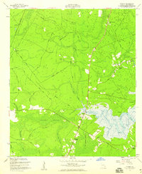
1955 Map of Eulonia
USGS Topo · Published 1959About this map
Eulonia and its surrounding coastal lowlands are defined by the winding course of the Sapelo River and expansive wetlands like Youngs Swamp and Jackey Camp Swamp. This mid-century survey reveals a rural landscape deeply tied to its geography, where settlements like Pine Harbor and Crescent sit near the tidal waters, while the interior is crisscrossed by specialized routes such as Dairy Line and Hammock Branch Road. Traces of earlier infrastructure are evident in the Old RR Grade and Old Railroad Grade that traverse the marshy terrain.
Find a feature on this map
41 named features on this map. Tap any name to fly to it.
Don’t see what you’re looking for? This feature index may not catch every label — zoom into the map to look around manually.
Map Details
Editions of this 1955 Eulonia Map
This is the sole edition of this map. No revisions or reprints were ever made.
Other maps of this area

1918 · Everett City
USGS Topo · 1:62,500

1920 · Sapelo River
USGS Topo · 1:62,500

1920 · Everett City
USGS Topo · 1:62,500

1921 · Darien
USGS Topo · 1:62,500

1943 · Ludowici
USGS Topo · 1:62,500

1943 · Sapelo River
USGS Topo · 1:62,500

1944 · Everett City
USGS Topo · 1:62,500

1945 · Sapelo River
USGS Topo · 1:62,500

1946 · Brunswick
USGS Topo · 1:250,000

1948 · Brunswick
USGS Topo · 1:250,000