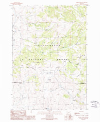
1988 Map of Eureka Basin
USGS Topo · Published 1988About this map
The Beaverhead National Forest defines this high-elevation landscape in the late 1980s, characterized by the steep divide of the Gravelly Range and the headwaters of several critical drainages. The Eureka Basin sits at the heart of the map, where the complex hydrology of the West Fork Madison River and the Ruby River begins to take shape. Evidence of mineral exploration and land management is scattered throughout the terrain, including a Mine Shaft, an Adit, and multiple coal outcroppings along Coal Creek. This provisional survey illustrates a working wilderness where recreational and administrative infrastructure, such as the West Fork FS Station and Roadside Park, meets the industrial history of the Montana mountains. The presence of the Gravelly Range Road provides the primary access through this remote portion of Madison and Beaverhead Counties, connecting secluded water sources like Lone Willow Spring and Fish Creek Lake.
Find a feature on this map
32 named features on this map. Tap any name to fly to it.
Don’t see what you’re looking for? This feature index may not catch every label — zoom into the map to look around manually.
Map Details
Editions of this 1988 Eureka Basin Map
2 editions found
Other maps of this area

1950 · Lower Red Rock Lake
USGS Topo · 1:62,500

1950 · Monument Ridge
USGS Topo · 1:62,500

1955 · Dubois
USGS Topo · 1:250,000

1955 · Ashton
USGS Topo · 1:250,000

1958 · Dubois
USGS Topo · 1:250,000

1958 · Ashton
USGS Topo · 1:250,000

1960 · Ashton
USGS Topo · 1:250,000

1968 · Stonehouse Mountain
USGS Topo · 1:24,000

1968 · Antelope Peak
USGS Topo · 1:24,000
1968 · Spur Mountain
USGS Topo · 1:24,000