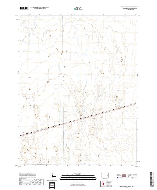
2022 Map of Eureka Creek South
USGS Topo · Published 2022About this map
The high plains of Cheyenne County are defined by the ephemeral drainage systems of Eureka Cr and Big Spring Cr, which carve subtle paths through the landscape of eastern Colorado. This topographic study reveals a sparse, rural environment characterized by a strictly organized section-line road network, including Co RD 25 and Co RD R. The presence of Little Spring and its corresponding Little Spring Creek in the northwest corner highlights the critical importance of water sources in this dry ranching country. The map's grid-like precision, punctuated by markers like Co RD P and Co RD 27, illustrates the enduring Public Land Survey System structure that has governed land ownership and agricultural boundaries in the region for over a century.
Find a feature on this map
16 named features on this map. Tap any name to fly to it.
Don’t see what you’re looking for? This feature index may not catch every label — zoom into the map to look around manually.
Map Details
Editions of this 2022 Eureka Creek South Map
This is the sole edition of this map. No revisions or reprints were ever made.
Other maps of this area

1891 · Kit Carson
USGS Topo · 1:125,000

1893 · Kit Carson
USGS Topo · 1:125,000

1954 · Lamar
USGS Topo · 1:250,000

1958 · Lamar
USGS Topo · 1:250,000

1981 · Cheyenne Wells
USGS Topo · 1:100,000
1982 · Kit Carson
USGS Topo · 1:24,000

1982 · Kit Carson 4 NE
USGS Topo · 1:24,000

1982 · Kit Carson 4 NW
USGS Topo · 1:24,000
1982 · Landsman Hill
USGS Topo · 1:24,000
1982 · Firstview
USGS Topo · 1:24,000