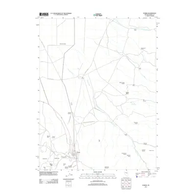
2012 Map of Eureka
USGS Topo · Published 2012About this map
Eureka anchors the southern portion of this Nevada survey, showing the town's dense layout at the head of Eureka Canyon. The surrounding terrain is heavily marked by its mineral and topographic history, with prominent landmarks such as Ruby Hill, Adams Hill, and Caribou Hill rising to the west. Roads like Wittenburg Rd and Ridgetop Rd navigate the steep grades near the settlement, while the town's civic life is centered at the Eureka Post Office. To the north, the landscape transitions into the broader expanse of Diamond Valley, where the character of the land shifts from mountainous mining territory to ranching. Named homesteads and livestock operations like LaBarry Ranch, Bank Ranch, and Eunice Place are scattered along the foothills of the Diamond Foothill, tied together by drainage systems such as Simpson Creek and Torre Creek.
Find a feature on this map
50 named features on this map. Tap any name to fly to it.
Don’t see what you’re looking for? This feature index may not catch every label — zoom into the map to look around manually.
Map Details
Editions of this 2012 Eureka Map
This is the sole edition of this map. No revisions or reprints were ever made.
Other maps of this area

1926 · Roberts Mountains
USGS Topo · 1:250,000

1929 · Roberts Mountains
USGS Topo · 1:250,000

1953 · Pinto Summit
USGS Topo · 1:62,500

1953 · Eureka
USGS Topo · 1:62,500

1955 · Millett
USGS Topo · 1:250,000

1956 · Bellevue Peak
USGS Topo · 1:62,500

1956 · Whistler Mtn
USGS Topo · 1:62,500

1956 · Ely
USGS Topo · 1:250,000

1959 · Ely
USGS Topo · 1:250,000

1959 · Millett
USGS Topo · 1:250,000