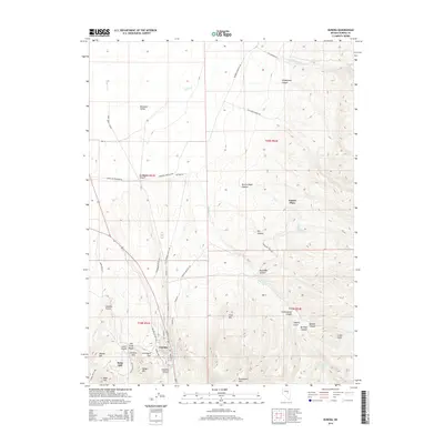
2014 Map of Eureka
USGS Topo · Published 2014About this map
Eureka sits at the southern base of the Diamond Valley, serving as a central point of settlement in this high-altitude landscape. The town is surrounded by a complex network of canyons and hills that speak to its history, including Graveyard Flat and the prominent Ruby Hill to the west. The rugged topography is etched with numerous named gulches and canyons such as Moritz Nager Canyon, Pastorino Canyon, and Newark Canyon, illustrating the challenging terrain that shaped early development and land use in this part of Nevada.
Find a feature on this map
58 named features on this map. Tap any name to fly to it.
Don’t see what you’re looking for? This feature index may not catch every label — zoom into the map to look around manually.
Map Details
Editions of this 2014 Eureka Map
This is the sole edition of this map. No revisions or reprints were ever made.
Other maps of this area

1926 · Roberts Mountains
USGS Topo · 1:250,000

1929 · Roberts Mountains
USGS Topo · 1:250,000

1953 · Pinto Summit
USGS Topo · 1:62,500

1953 · Eureka
USGS Topo · 1:62,500

1955 · Millett
USGS Topo · 1:250,000

1956 · Bellevue Peak
USGS Topo · 1:62,500

1956 · Whistler Mtn
USGS Topo · 1:62,500

1956 · Ely
USGS Topo · 1:250,000

1959 · Ely
USGS Topo · 1:250,000

1959 · Millett
USGS Topo · 1:250,000