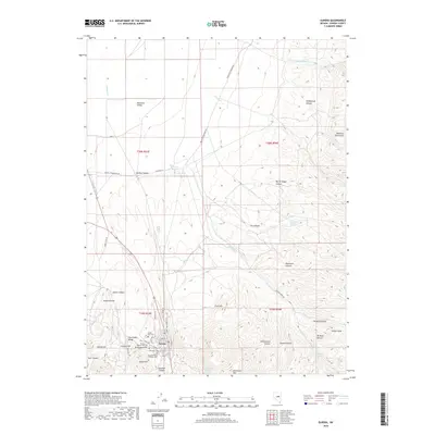
2018 Map of Eureka
USGS Topo · Published 2018About this map
The settlement of Eureka serves as the focal point of this high-desert landscape, situated where the Fish Creek Range meets the southern end of the Diamond Valley. This 2018 survey documents a region defined by its rugged topography and deep historical roots, evident in the cluster of burial sites south of the main townsite. Genealogists and local historians can trace the community's legacy through labels for the Cedar Hills Cem, Eureka Masonic Cem, Schwab Cem, and Saint Brendans Catholic Cem. The surrounding terrain is marked by sharp elevation changes, from the prominent Richmond Mtn and Crater Cone to the winding corridors of Eureka Canyon and Newark Canyon. Water sources like Simpson Springs and Four-eyed Nicks Springs remain critical landmarks in this arid environment, while the proximity of Graveyard Flat and Spanish Gulch suggests a landscape long shaped by mining and ranching interests.
Find a feature on this map
53 named features on this map. Tap any name to fly to it.
Don’t see what you’re looking for? This feature index may not catch every label — zoom into the map to look around manually.
Map Details
Editions of this 2018 Eureka Map
This is the sole edition of this map. No revisions or reprints were ever made.
Other maps of this area

1926 · Roberts Mountains
USGS Topo · 1:250,000

1929 · Roberts Mountains
USGS Topo · 1:250,000

1953 · Pinto Summit
USGS Topo · 1:62,500

1953 · Eureka
USGS Topo · 1:62,500

1955 · Millett
USGS Topo · 1:250,000

1956 · Bellevue Peak
USGS Topo · 1:62,500

1956 · Whistler Mtn
USGS Topo · 1:62,500

1956 · Ely
USGS Topo · 1:250,000

1959 · Ely
USGS Topo · 1:250,000

1959 · Millett
USGS Topo · 1:250,000