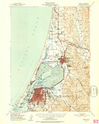
1951 Map of Eureka
USGS Topo · Published 1953About this map
Humboldt Bay and its complex system of sloughs anchor this 1951 survey of California's northern coast. The city of Eureka is shown in considerable detail, with its street grid expanding south toward Cutten and east to Rosewood. The industrial and maritime character of the era is evident along the North Spit, where the company town of Samoa and various lighthouse and coast guard stations overlook the Pacific. To the north, the growing community of Arcata is defined by the presence of Humboldt State College and the junction of the Northwestern Pacific railroad.
Find a feature on this map
91 named features on this map. Tap any name to fly to it.
Don’t see what you’re looking for? This feature index may not catch every label — zoom into the map to look around manually.
Map Details
Editions of this 1951 Eureka Map
2 editions found

Other maps of this area

1916 · Cape Fortunas
USGS Topo · 1:62,500

1922 · Eureka
USGS Topo · 1:62,500

1922 · Korbel
USGS Topo · 1:62,500

1922 · Kneeland
USGS Topo · 1:62,500

1925 · Hoopa
USGS Topo · 1:125,000

1933 · Eureka
USGS Topo · 1:48,000

1942 · Eureka
USGS Topo · 1:62,500

1943 · Ferndale
USGS Topo · 1:62,500

1944 · Fortuna
USGS Topo · 1:62,500

1945 · Trinidad
USGS Topo · 1:62,500