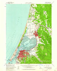
1959 Map of Eureka
USGS Topo · Published 1961About this map
Humboldt Bay and Arcata Bay define this 1959 coastal landscape, where the shifting Samoa Dunes separate the open Pacific Ocean from a complex system of sloughs and tidal channels. The mid-century urban core of Eureka is shown in high detail, featuring the State Historical Monument and County Hospital, while to the north, Arcata serves as a hub for the region, anchored by the Humboldt State College campus.
Find a feature on this map
117 named features on this map. Tap any name to fly to it.
Don’t see what you’re looking for? This feature index may not catch every label — zoom into the map to look around manually.
Map Details
Editions of this 1959 Eureka Map
2 editions found
Other maps of this area

1916 · Cape Fortunas
USGS Topo · 1:62,500

1922 · Eureka
USGS Topo · 1:62,500

1922 · Korbel
USGS Topo · 1:62,500

1922 · Kneeland
USGS Topo · 1:62,500

1925 · Hoopa
USGS Topo · 1:125,000

1933 · Eureka
USGS Topo · 1:48,000

1942 · Eureka
USGS Topo · 1:62,500

1943 · Ferndale
USGS Topo · 1:62,500

1944 · Fortuna
USGS Topo · 1:62,500

1945 · Trinidad
USGS Topo · 1:62,500