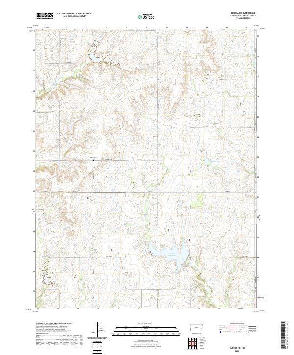
2022 Map of Eureka NE
USGS Topo · Published 2022About this map
Bachelor Creek and its various branches, such as Bachelor Cr and Swing Cr, carve a complex drainage pattern through this section of Greenwood County. The landscape is defined by its water management and agricultural grid, anchored in the south by the significant expanse of Eureka City Lake, which is accessible via Eureka Lake Rd. Further north, smaller impoundments like Munger Lake suggest the importance of local water storage for the surrounding ranching or farming operations. For those researching family history in the area, Highland Cem sits centrally located along 230th St, providing a key genealogical landmark in an otherwise rural expanse of section lines and township roads such as Twp Rd 326 and Co Rd 8.
Find a feature on this map
42 named features on this map. Tap any name to fly to it.
Don’t see what you’re looking for? This feature index may not catch every label — zoom into the map to look around manually.
Map Details
Editions of this 2022 Eureka NE Map
This is the sole edition of this map. No revisions or reprints were ever made.
Other maps of this area

1885 · Eureka
USGS Topo · 1:125,000

1888 · Emporia
USGS Topo · 1:125,000

1888 · Eureka
USGS Topo · 1:125,000

1894 · Emporia
USGS Topo · 1:125,000

1894 · Eureka
USGS Topo · 1:125,000

1955 · Wichita
USGS Topo · 1:250,000

1955 · Hutchinson
USGS Topo · 1:250,000

1958 · Wichita
USGS Topo · 1:250,000

1959 · Hutchinson
USGS Topo · 1:250,000

1967 · Madison SW
USGS Topo · 1:24,000