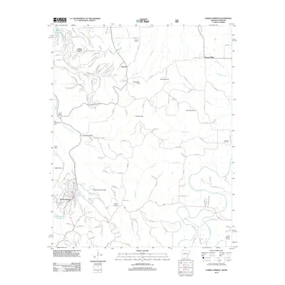
2012 Map of Eureka Springs
USGS Topo · Published 2012About this map
Eureka Springs serves as the focal point of this Northwest Arkansas landscape, where the unique topography influenced the development of its winding residential streets and mountain landmarks. Significant geological and cultural features like Pivot Rock and Mount Oberammergau stand alongside more contemporary developments such as Holiday Island near the Missouri border. The map documents a complex hydrological network including the Kings River, Osage Creek, and the waters near Lake Leatherwood Dam. For genealogists and local historians, the sheet provides precise locations for several burial grounds, including the Eureka Springs Cemetery, Oak Hill Cemetery, Gaskins Switch Cemetery, and Grandview Cemetery. The proximity of the Carroll County Airport and the winding course of Leatherwood Creek illustrate the intersection of modern infrastructure with the area's natural spring-fed geography, including the notable Magnetic Spring site.
Find a feature on this map
160 named features on this map. Tap any name to fly to it.
Don’t see what you’re looking for? This feature index may not catch every label — zoom into the map to look around manually.
Map Details
Editions of this 2012 Eureka Springs Map
This is the sole edition of this map. No revisions or reprints were ever made.
Other maps of this area

1900 · Eureka Springs
USGS Topo · 1:125,000

1901 · Eureka Springs
USGS Topo · 1:125,000

1927 · Shell Knob
USGS Topo · 1:62,500

1937 · Cassville
USGS Topo · 1:48,000

1944 · Cassville
USGS Topo · 1:62,500

1945 · Harrison
USGS Topo · 1:250,000

1949 · Harrison
USGS Topo · 1:250,000

1950 · Shell Knob
USGS Topo · 1:62,500

1954 · Harrison
USGS Topo · 1:250,000

1957 · Mundell
USGS Topo · 1:24,000