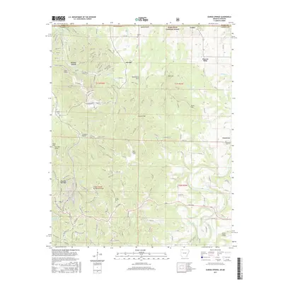
2017 Map of Eureka Springs
USGS Topo · Published 2017About this map
Eureka Springs serves as the focal point of this region, characterized by its winding streets like Breezy Point Rd and Grand Ave that navigate the varied Ozark terrain. The town's historical and spiritual identity is reflected in landmarks like Mt Oberrammergau and the proximity to the mineral-rich Magnetic Spring. To the north, the planned community of Holiday Island reaches toward the waters of Table Rock Lake at the Missouri border, while the surrounding landscape is marked by hollows and points such as Pivot Rock Hollow and Huckleberry Point.
Find a feature on this map
64 named features on this map. Tap any name to fly to it.
Don’t see what you’re looking for? This feature index may not catch every label — zoom into the map to look around manually.
Map Details
Editions of this 2017 Eureka Springs Map
This is the sole edition of this map. No revisions or reprints were ever made.
Other maps of this area

1900 · Eureka Springs
USGS Topo · 1:125,000

1901 · Eureka Springs
USGS Topo · 1:125,000

1927 · Shell Knob
USGS Topo · 1:62,500

1937 · Cassville
USGS Topo · 1:48,000

1944 · Cassville
USGS Topo · 1:62,500

1945 · Harrison
USGS Topo · 1:250,000

1949 · Harrison
USGS Topo · 1:250,000

1950 · Shell Knob
USGS Topo · 1:62,500

1954 · Harrison
USGS Topo · 1:250,000

1957 · Mundell
USGS Topo · 1:24,000