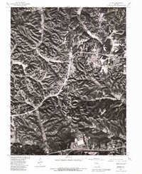
1979 Map of Eureka
USGS Topo · Published 1981About this map
Grover and Glencoe anchor this 1979 orthophotographic study of the Missouri landscape just west of St. Louis. Unlike a traditional topographic sheet, this imagery provides a direct view of the land use patterns during the late seventies, showing the transition between established settlements and the wooded ridges and valleys. The southern edge of the map follows the winding path of the Meramec River, which cuts through the bottom of the frame near Eureka and Allenton. The map effectively documents the extent of residential development and agricultural clearing in these communities before the rapid suburban expansion of later decades. By overlaying 1954 land lines onto 1979 aerial photography, the document captures how property boundaries persisted even as the physical landscape changed over twenty-five years.
Find a feature on this map
5 named features on this map. Tap any name to fly to it.
Don’t see what you’re looking for? This feature index may not catch every label — zoom into the map to look around manually.
Map Details
Editions of this 1979 Eureka Map
This is the sole edition of this map. No revisions or reprints were ever made.
Other maps of this area

1901 · De Soto
USGS Topo · 1:125,000

1903 · O'Fallon
USGS Topo · 1:125,000

1931 · Manchester SE
USGS Topo · 1:24,000

1931 · Pacific NE
USGS Topo · 1:24,000

1932 · Manchester NE
USGS Topo · 1:24,000

1937 · Pacific
USGS Topo · 1:24,000

1937 · Weldon Spring
USGS Topo · 1:24,000

1940 · Eureka
USGS Topo · 1:24,000

1940 · Weldon Spring
USGS Topo · 1:24,000

1944 · Eureka
USGS Topo · 1:24,000