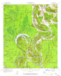
1960 Map of Eva
USGS Topo · Published 1961About this map
The Black River meanders through the heart of the central Louisiana lowlands, defining the intricate border between Catahoula and Concordia Parishes. This 1960 landscape is a complex network of bayous, brakes, and ridges, where life follows the natural rhythm of the water. Small rural communities like Mayna, New Era, and Acme are connected by winding roads that skirt the edges of vast wetlands such as Gillespie Brake and Hudson Brake. Local social life is anchored by numerous country churches, including Glade Ch, Cynthia Bayou Ch, and Parhams Ch, alongside the Central Sch.
Find a feature on this map
121 named features on this map. Tap any name to fly to it.
Don’t see what you’re looking for? This feature index may not catch every label — zoom into the map to look around manually.
Map Details
Editions of this 1960 Eva Map
3 editions found
Other maps of this area

1935 · Tooleys
USGS Topo · 1:62,500

1939 · Red Gum
USGS Topo · 1:62,500

1939 · Artonish
USGS Topo · 1:62,500

1939 · Deer Park
USGS Topo · 1:62,500

1940 · Marksville
USGS Topo · 1:62,500

1941 · Manifest
USGS Topo · 1:62,500

1941 · Jena
USGS Topo · 1:62,500

1941 · Voorhies
USGS Topo · 1:62,500

1941 · Buckeye
USGS Topo · 1:62,500

1941 · Tooleys
USGS Topo · 1:62,500