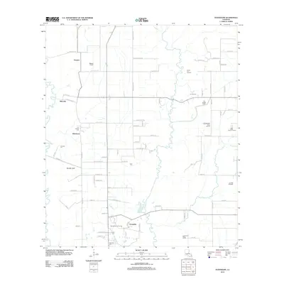
2012 Map of Evangeline
USGS Topo · Published 2012About this map
Evangeline and the surrounding prairies of Acadia Parish reveal a landscape defined by its petrochemical industry and deep-rooted family settlements. This area is characterized by the expansive Jennings Oil and Gas Field and the Iota Oil and Gas Field, which represent the long-standing energy economy of southern Louisiana. Genealogists and local historians will find several family-named burial grounds throughout the countryside, including Little Mamou Cem, Riverside Cem, and the Lockett Cem. The local infrastructure is deeply tied to water management, with the Mamou Canal, Riverside Canal, and L I and M Canal cutting through the terrain to support irrigation and drainage across the coastal plain. Notable local landmarks such as the Iota Racetrack and the Zaunbrecher Strip Airport suggest the recreational and logistical patterns of the community in the early twenty-first century.
Find a feature on this map
77 named features on this map. Tap any name to fly to it.
Don’t see what you’re looking for? This feature index may not catch every label — zoom into the map to look around manually.
Map Details
Editions of this 2012 Evangeline Map
This is the sole edition of this map. No revisions or reprints were ever made.
Other maps of this area

1946 · Mermentau
USGS Topo · 1:31,680

1946 · Jennings
USGS Topo · 1:31,680

1947 · Evangeline
USGS Topo · 1:31,680

1947 · Elton
USGS Topo · 1:31,680

1947 · Eunice
USGS Topo · 1:31,680

1947 · Hathaway
USGS Topo · 1:31,680

1947 · Iota
USGS Topo · 1:31,680

1947 · Basile
USGS Topo · 1:31,680

1949 · Estherwood
USGS Topo · 1:31,680

1949 · Basile
USGS Topo · 1:31,680