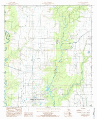
1985 Map of Evangeline
USGS Topo · Published 1985About this map
The Jennings Oil and Gas Field dominates the southern landscape of this Acadia Parish map, reflecting the area's long-standing reliance on petroleum extraction. This industrial hub is situated near Evangeline, where a network of pipelines and transmission lines crisscross the terrain. The landscape is defined by its sophisticated water management systems, including the Mamou Canal, Riverside Canal, and an Abandoned Canal, which serve the agricultural needs of the coastal prairie. The natural meandering courses of Bayou Des Cannes and Bayou Nezpique form prominent geographical boundaries against the man-made grid of canals and section lines. Small settlements like Iota and Millerville anchor the eastern and western portions of the quadrangle, while recreational or specialized sites like the Race Track near the center indicate the diverse land use in this Louisiana interior.
Find a feature on this map
17 named features on this map. Tap any name to fly to it.
Don’t see what you’re looking for? This feature index may not catch every label — zoom into the map to look around manually.
Map Details
Editions of this 1985 Evangeline Map
This is the sole edition of this map. No revisions or reprints were ever made.
Other maps of this area

1946 · Mermentau
USGS Topo · 1:31,680

1946 · Jennings
USGS Topo · 1:31,680

1947 · Evangeline
USGS Topo · 1:31,680

1947 · Elton
USGS Topo · 1:31,680

1947 · Eunice
USGS Topo · 1:31,680

1947 · Hathaway
USGS Topo · 1:31,680

1947 · Iota
USGS Topo · 1:31,680

1947 · Basile
USGS Topo · 1:31,680

1949 · Estherwood
USGS Topo · 1:31,680

1949 · Basile
USGS Topo · 1:31,680