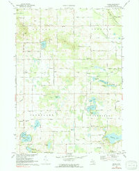
1972 Map of Evans
USGS Topo · Published 1991About this map
Glacial lakes and small rural settlements dot the landscape of north-central Kent County, Michigan, as seen in this early 1970s survey. The area is defined by the four-corner township boundaries of Nelson, Spencer, Courtland, and Oakfield. Small communities like Evans and Harvard are situated along the Old Railroad Grade, reflecting the historical importance of the rail line to these local hubs.
Find a feature on this map
66 named features on this map. Tap any name to fly to it.
Don’t see what you’re looking for? This feature index may not catch every label — zoom into the map to look around manually.
Map Details
Editions of this 1972 Evans Map
2 editions found
Other maps of this area

1918 · Cedar Springs
USGS Topo · 1:62,500

1943 · Cedar Springs
USGS Topo · 1:62,500

1954 · Midland
USGS Topo · 1:250,000

1958 · Midland
USGS Topo · 1:250,000

1958 · Sand Lake
USGS Topo · 1:62,500

1959 · Midland
USGS Topo · 1:250,000

1959 · Howard City
USGS Topo · 1:62,500

1966 · Midland
USGS Topo · 1:250,000

1967 · Cedar Springs
USGS Topo · 1:24,000
1967 · Rockford
USGS Topo · 1:24,000