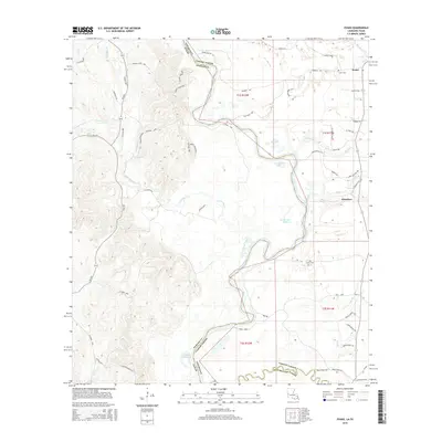
2015 Map of Evans
USGS Topo · Published 2015About this map
The Sabine River snakes through this borderland, creating a complex hydrologic boundary between Louisiana and Texas. The river's historical shifts are evident in the presence of Evans Old River and Fowler Old River, oxbow remnants that mark former channels and now define the low-lying wetlands of the valley. Settlement is concentrated on the eastern side in Vernon Parish, primarily centered around the community of Evans and the village of Almadane.
Find a feature on this map
71 named features on this map. Tap any name to fly to it.
Don’t see what you’re looking for? This feature index may not catch every label — zoom into the map to look around manually.
Map Details
Editions of this 2015 Evans Map
This is the sole edition of this map. No revisions or reprints were ever made.
Other maps of this area

1941 · Leesville
USGS Topo · 1:62,500

1943 · Leesville
USGS Topo · 1:62,500

1944 · Wiergate
USGS Topo · 1:62,500

1946 · Leesville
USGS Topo · 1:62,500

1946 · Merryville
USGS Topo · 1:31,680

1947 · Pujo
USGS Topo · 1:31,680

1947 · Knight
USGS Topo · 1:31,680

1948 · Leesville
USGS Topo · 1:62,500

1948 · Wiergate
USGS Topo · 1:62,500

1949 · Evans
USGS Topo · 1:31,680