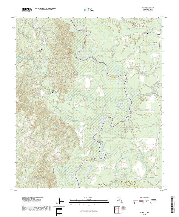
2024 Map of Evans
USGS Topo · Published 2024About this map
The Sabine River defines the border between Louisiana and Texas in this rural corridor, where the floodplain is carved by abandoned channels and oxbows like Evans Old River and Fowler Old River. The small community of Evans serves as a local hub near the Evans Cem, while the settlement of Almadane sits further south near Mill Creek. The landscape is a mosaic of dense bottomland wetlands and upland pines, punctuated by family and community landmarks such as Spears Chapel Cem and Cedar Grove Cem.
Find a feature on this map
70 named features on this map. Tap any name to fly to it.
Don’t see what you’re looking for? This feature index may not catch every label — zoom into the map to look around manually.
Map Details
Editions of this 2024 Evans Map
This is the sole edition of this map. No revisions or reprints were ever made.
Other maps of this area

1941 · Leesville
USGS Topo · 1:62,500

1943 · Leesville
USGS Topo · 1:62,500

1944 · Wiergate
USGS Topo · 1:62,500

1946 · Leesville
USGS Topo · 1:62,500

1946 · Merryville
USGS Topo · 1:31,680

1947 · Pujo
USGS Topo · 1:31,680

1947 · Knight
USGS Topo · 1:31,680

1948 · Leesville
USGS Topo · 1:62,500

1948 · Wiergate
USGS Topo · 1:62,500

1949 · Evans
USGS Topo · 1:31,680