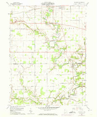
1960 Map of Evansport
USGS Topo · Published 1974About this map
The Tiffin River meanders southward through the agricultural heart of northwest Ohio, serving as the central geographic feature for the rural communities of Stryker and Evansport. This 1960s landscape is defined by a dense grid of family-named roads, including Beerbower Road and Bostater Road, which connect scattered farmsteads to local landmarks like the Township High Sch and St Johns Ch. The presence of the Penn Central railroad corridor in the north and the Williams County Airport near the border of Pulaski township illustrates the evolving transportation infrastructure of the era. Genealogists will find significant value in the detailed plotting of local burial grounds, such as Boynton Cem and Oak Ridge Cem, alongside various township halls and rural chapels that anchored these farming townships before modern consolidations.
Find a feature on this map
44 named features on this map. Tap any name to fly to it.
Don’t see what you’re looking for? This feature index may not catch every label — zoom into the map to look around manually.
Map Details
Editions of this 1960 Evansport Map
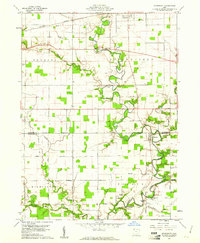
2 editions found
Other maps of this area

1907 · Defiance
USGS Topo · 1:62,500

1909 · Defiance
USGS Topo · 1:62,500

1913 · Alvordton
USGS Topo · 1:62,500

1914 · Pioneer
USGS Topo · 1:62,500

1914 · Bryan
USGS Topo · 1:62,500

1943 · Bryan
USGS Topo · 1:62,500

1944 · Pioneer
USGS Topo · 1:62,500

1944 · Alvordton
USGS Topo · 1:62,500

1953 · Fort Wayne
USGS Topo · 1:250,000

1956 · Fort Wayne
USGS Topo · 1:250,000