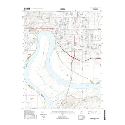
2016 Map of Evansville South
USGS Topo · Published 2016About this map
Evansville, Indiana, and Henderson, Kentucky, are linked by the massive southern bend of the Ohio River, which serves as both a geographic center and a complex political boundary in this 2016 survey. The map details a landscape where heavy urban development and industrial corridors meet a dense network of river-bottom wetlands. The northern section is dominated by the grid of Evansville, featuring the Univ of Evansville and the sprawling grounds of Oak Hill Cem.
Find a feature on this map
254 named features on this map. Tap any name to fly to it.
Don’t see what you’re looking for? This feature index may not catch every label — zoom into the map to look around manually.
Map Details
Editions of this 2016 Evansville South Map
This is the sole edition of this map. No revisions or reprints were ever made.
Other maps of this area

1901 · Haubstadt
USGS Topo · 1:62,500

1902 · Ditney
USGS Topo · 1:125,000

1902 · Boonville
USGS Topo · 1:62,500

1903 · Haubstadt
USGS Topo · 1:62,500

1903 · Patoka
USGS Topo · 1:125,000

1905 · Newburg
USGS Topo · 1:62,500

1914 · Henderson
USGS Topo · 1:48,000

1916 · Henderson
USGS Topo · 1:62,500

1951 · Spottsville
USGS Topo · 1:24,000

1952 · Evansville
USGS Topo · 1:24,000